
Key Takeaways
Walking through Las Palmas Medellín is best treated as a scenic hillside outing, not a conventional neighborhood stroll.
- Las Palmas rises east of El Poblado toward the airport corridor.
- The main road offers broad valley views but has heavy, fast traffic.
- Side streets and restaurant areas vary greatly in walkability.
- Daylight, practical footwear, and discreet valuables improve the experience.
- Combining a short walk with a taxi gives us more flexibility.
Where Las Palmas is and what to expect
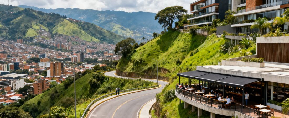
Walking through Las Palmas Medellín gives us valley views, steep roads, and a mixed hillside setting. The area sits above El Poblado and follows the eastern route toward José María Córdova International Airport. We should expect attractive viewpoints and restaurants, but not continuous pedestrian infrastructure.
How Las Palmas connects to El Poblado
Las Palmas begins above the eastern side of El Poblado and climbs away from the dense restaurant districts. Provenza and Parque Lleras provide practical starting points because they have food, transport, and familiar meeting places. From there, the route quickly becomes steeper and more road-oriented.
The connection is geographically close but not always comfortable on foot. We can walk uphill from selected streets, then use a taxi when sidewalks narrow or traffic increases. This approach works better than assuming the entire climb is a pleasant urban promenade.
The difference between the road and hillside areas
The Las Palmas road is a major corridor with vehicles heading toward the airport and eastern suburbs. It includes viewpoints, commercial properties, restaurants, and stretches where pedestrians share limited roadside space. The road can feel open and scenic while remaining difficult to cross safely.
Higher hillside areas contain residential streets, apartment buildings, and businesses set back from the main route. Some streets are calmer, but they may have steep grades, incomplete sidewalks, or little activity. We should judge each segment separately rather than describing all Las Palmas as equally walkable.
Why the neighborhood feels different from central Medellín
Central Medellín has a denser street grid, more continuous storefronts, and stronger pedestrian movement. Las Palmas feels more dispersed because buildings follow the slope and commercial destinations sit farther apart. The changing elevation also makes the city appear below us rather than around us.
This difference affects how we plan time. A map may show a short distance, yet the incline, road crossings, and pauses for views can extend the outing. The setting suits a deliberately paced walk more than spontaneous wandering between nearby attractions.
What type of traveler will enjoy walking here
Las Palmas suits travelers who enjoy viewpoints, hillside architecture, and a walk with a clear destination. It is also useful for visitors who want to combine a restaurant stop with a short outdoor excursion. People seeking flat sidewalks, frequent shops, or effortless transit should choose another area.
We can make the experience more comfortable by selecting one manageable segment. A short downhill walk after arriving by car is often easier than starting at the bottom. The strongest appeal is the changing view, not the number of streets covered.
How to plan a walking route through Las Palmas
A useful Las Palmas walking route starts with one destination and a return plan. We should check the gradient, road crossings, opening hours, and weather before leaving El Poblado. The route is more enjoyable when walking remains the main activity without becoming the only transport option.
Starting points near Provenza and Parque Lleras
Provenza and Parque Lleras are convenient starting areas because we can eat, withdraw cash, or arrange transport there. From either district, we can walk toward the lower Las Palmas connections before deciding whether to continue uphill. The Provenza neighborhood guide is useful for understanding the dining streets before setting out.
We should avoid treating Parque Lleras as the actual beginning of a long hillside trek. The road layout changes quickly, and a route that looks direct may involve steep turns or busy junctions. Starting from a planned pickup point gives us an easier exit if conditions change.
Routes toward viewpoints and hillside restaurants
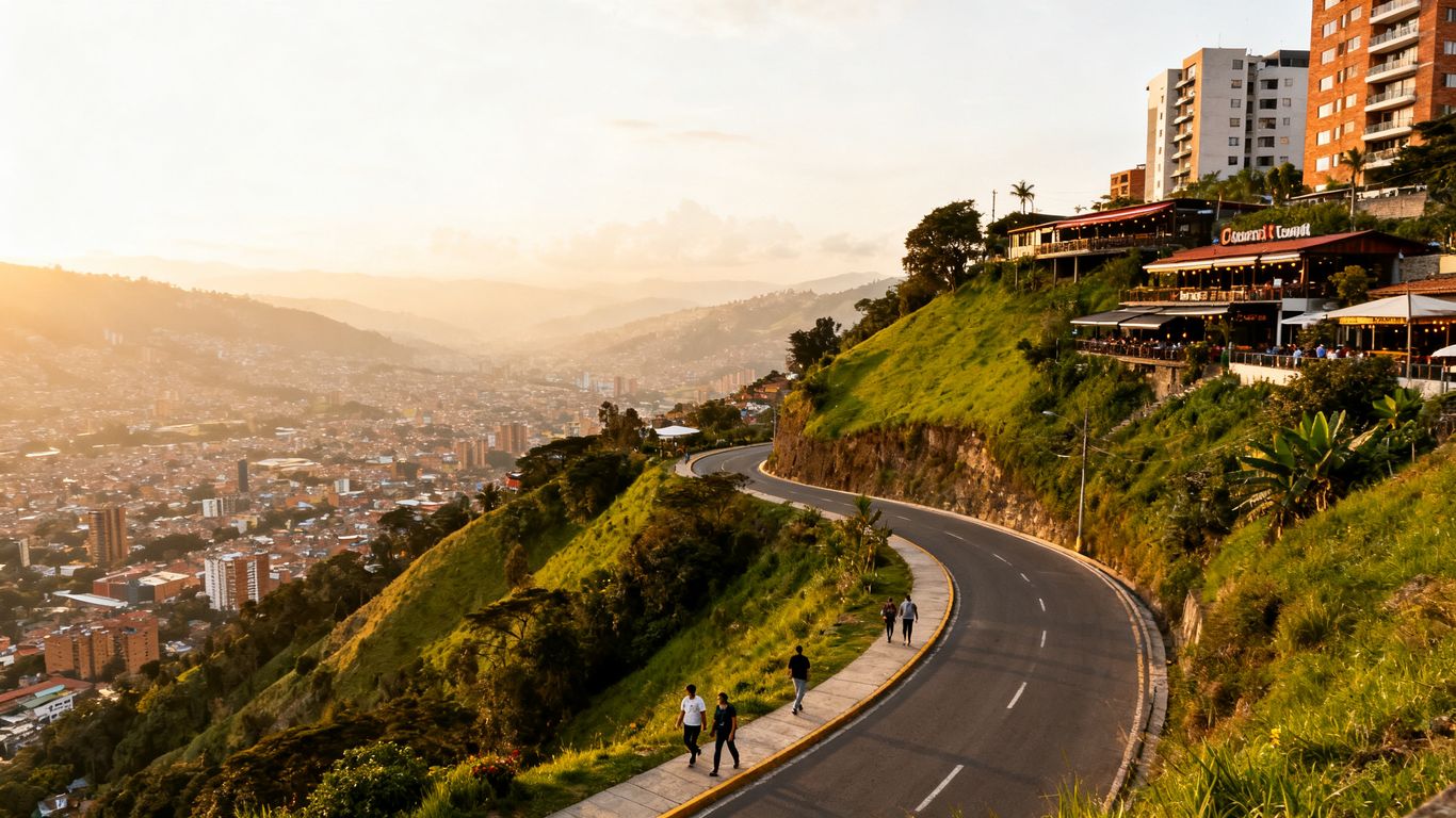
The most rewarding routes generally aim toward a viewpoint, terrace, or restaurant rather than an arbitrary street. We can walk a short, visible section, pause for the panorama, and continue only if the roadside feels comfortable. Several viewpoints are reached more practically by vehicle, with walking reserved for the final portion.
A route guide can help us compare distances, although online listings may be incomplete. One external walking resource identifies a route near Lakes of Moreno Bridge, but we should verify current access and conditions locally. The broader Las Palmas walking routes search can provide another starting point for route planning.
How to combine walking with taxis or ride-hailing
A taxi or ride-hailing vehicle lets us skip the least pleasant climb and walk the segment with the best views. We can also arrange pickup from a restaurant or shopping destination before beginning. This is especially helpful when the road becomes dark, wet, or congested.
We should use the application’s displayed vehicle details and confirm the pickup location away from moving traffic. Keeping a charged phone and a second transport option reduces pressure to continue walking. A flexible return plan matters more here than completing a particular mileage target.
When a route becomes impractical on foot
A route becomes impractical when the sidewalk disappears, vehicles pass close by, or the next destination is separated by a fast junction. Steep grades also change the effort required, especially in direct sun or after rain. We should turn around before the route feels forced.
The following checks help us make that decision without overthinking it:
- Is there a continuous place for pedestrians to walk?
- Can we cross the road without entering a blind curve?
- Are businesses or other people nearby during the planned time?
- Do we have enough battery and transport coverage for the return?
These questions keep the walk enjoyable and prevent a scenic outing from becoming an exhausting roadside hike. A short, well-chosen segment is still a successful Las Palmas walk.
What you will see along the way
Las Palmas offers a different visual experience from Medellín’s central districts. We move between broad valley views, planted slopes, restaurants, and residential construction. The scenery changes with elevation, road direction, cloud cover, and the amount of development along each stretch.
Medellín viewpoints from the Las Palmas road
The main attraction is the view across the Aburrá Valley, especially from elevated road sections and terraces. On clear days, we can see the city spreading along the valley floor with mountains beyond it. The perspective changes constantly as the road bends and rises.
We should stop only where pedestrians can stand safely and where vehicles have clear visibility. A lookout beside a road may offer a strong photograph but little protection from traffic. Viewpoint guides such as Medellín panoramic lookouts can help us identify alternatives that require less roadside walking.
Restaurants, cafés, and local businesses
Restaurants and cafés appear as separate destinations rather than as one continuous commercial strip. Some have terraces or elevated settings, while others serve the local residential population. We should check the exact location and opening hours before committing to a walk.
A planned meal gives the route structure and creates a reliable place to rest. It also means we can arrive by vehicle and explore nearby surroundings without carrying food or water for the entire climb. The area feels more manageable when we treat businesses as anchors.
Residential streets and hillside architecture
Residential streets reveal how construction adapts to the slope. We may see apartment towers, guarded entrances, retaining walls, and houses positioned above the road. These areas are generally for residents, so we should observe quietly and avoid photographing private entrances.
The architecture is less uniform than the restaurant imagery suggests. Newer buildings sit beside older roads and thick vegetation, creating abrupt changes within a short distance. Those contrasts make a slow walk interesting, even when there is no formal attraction.
Green spaces and changing city views
Vegetation appears in pockets along slopes, property edges, and undeveloped spaces. The greenery softens the road corridor and gives us occasional shade, though it does not guarantee a public trail. We should not enter fenced land or assume that a wooded slope is an accessible park.
Morning clouds can partly hide the valley, while later breaks may reveal more of the city. We can use the changing view as a reason to pause rather than rushing toward the highest point. The best visual experience often comes from several modest stops.
Safety considerations for walking in Las Palmas
Walking in Las Palmas requires more attention to traffic and route isolation than to crime alone. Conditions change between busy commercial areas, residential streets, and the main airport road. We should stay visible, travel during useful daylight, and keep a simple transport plan.
Which areas are more suitable during daylight
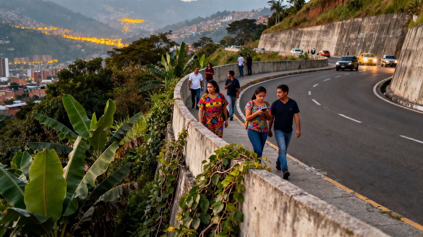
Daylight is the clearest choice for exploring unfamiliar hillside roads and viewpoints. It helps us read the pavement, identify safe crossings, and notice whether a business or public place is open. Busy areas near restaurants and established destinations usually feel more practical than empty connectors.
We should not interpret daytime activity as a complete safety guarantee. Normal city precautions still apply, particularly when using phones near the roadside. The Parque Lleras safety guide offers useful context for securing belongings before we leave the busier nightlife district.
Why traffic is a bigger concern than distance
The road’s physical distance can look manageable, but fast vehicles and narrow shoulders create the greater problem. Curves reduce visibility, and drivers may not expect pedestrians outside commercial entrances. We should walk facing traffic where appropriate and avoid stepping into the roadway for photographs.
Crossing should happen only where visibility is good and the road design allows it. If we cannot identify a safe crossing, we should use a vehicle to reach the next section. No viewpoint justifies taking chances beside moving traffic.
How to avoid isolated roads and dark side streets
We can avoid isolation by planning around open businesses, visible entrances, and roads with regular activity. Side streets that look like shortcuts may become quiet quickly, particularly after sunset or during heavy rain. A map pin alone does not tell us whether a route feels comfortable on foot.
We should share our approximate route with someone and keep navigation available without displaying the phone continuously. If the surroundings become empty or poorly lit, returning to the main road is sensible. Calling transport from a recognized business is usually easier than waiting on an isolated corner.
What valuables and transport precautions to take
We should carry only what the walk requires and keep phones, cameras, and wallets out of casual view. A small crossbody bag worn securely is easier to manage than an open backpack pocket. We should also avoid accepting unsolicited transport offers.
For taxis or ride-hailing, we can verify the plate, driver, and destination before entering. Paying through a trusted application or using small amounts of cash reduces unnecessary handling. These habits are ordinary, but they matter more when the route has fewer pedestrians.
Practical details for a comfortable walk
Comfort depends on preparing for elevation, sun, and changing conditions. Las Palmas can feel cooler at higher points, while exposed road sections may become warm quickly. We should plan fewer kilometers than we might walk on a flat city route.
Weather, sun exposure, and changing temperatures
Medellín’s mild climate does not remove the need for sun protection. The road can offer little shade, and the slope increases effort even when the temperature feels moderate. We should carry water, apply sunscreen, and bring a light layer for cooler elevated sections.
Rain can make painted surfaces, stone edges, and steep pavement slippery. A compact rain jacket is more useful than relying on a forecast alone. If clouds build over the hills, we should shorten the route before visibility and footing deteriorate.
Footwear for steep roads and uneven sidewalks
Supportive shoes with reliable traction are more suitable than sandals or smooth casual soles. Sidewalks may change height, end suddenly, or tilt toward the road. We should choose footwear for control and comfort rather than appearance.
Trekking poles are unnecessary for most short outings, but a steady pace helps on descents. Downhill sections can strain knees more than expected. Leaving room in the schedule for pauses also reduces hurried steps near traffic.
Where to stop for water, food, or rest
We should identify at least one planned stop before starting uphill. Restaurants, cafés, and shopping destinations provide shade, bathrooms, and a place to reassess the route. Carrying a small bottle remains wise because businesses are not evenly spaced.
For broader food planning elsewhere in the city, our guide to Medellín street food explains local staples and practical eating considerations. That information is more useful before the walk than while searching from a quiet roadside. We can then choose a Las Palmas stop based on location rather than hunger alone.
How mobile data and navigation apps help
Mobile data helps us compare routes, monitor pickup points, and check whether a destination is still open. Downloading a map area beforehand is sensible because signal quality can vary around bends and built-up slopes. We should also save the address of the return destination.
Navigation should support local judgment, not replace it. If the app directs us through a narrow or empty road, we can choose the longer visible route. A screenshot of the accommodation or meeting point provides a useful backup when the battery runs low.
The best times to walk through Las Palmas
The right time depends on our priorities: cooler effort, clearer views, or restaurant availability. Daylight generally gives us better visibility and more practical transport choices. We should also allow extra time because elevation makes short routes slower.
Morning conditions for longer walks
Morning is usually the most comfortable period for a longer uphill outing. Temperatures are often gentler, and we have more daylight to correct a wrong turn. Clouds may cover parts of the valley, but that can change as the day develops.
Starting early also reduces the chance of finishing beside a busy road after dark. We can schedule breakfast in El Poblado, walk one segment, and return by vehicle. This creates a clear boundary for the excursion.
Afternoon routes with clearer city views
Afternoon can offer better openings in the cloud and stronger visibility across the valley. It works well for a shorter route followed by a restaurant reservation. We should monitor traffic and avoid assuming that a late departure leaves enough daylight.
The sun may be intense on exposed sections, even when the air remains cool. Water and a hat make the route easier. If views are the priority, we can choose a destination with a terrace rather than spending the entire afternoon on the roadside.
Sunset considerations and reduced visibility
Sunset is attractive from west-facing elevated areas, but visibility declines quickly afterward. Medellín’s valley setting can become dark soon after the sun disappears. We should arrive early, confirm the return pickup, and avoid walking unfamiliar connectors afterward.
A viewpoint visit at sunset is therefore different from a sunset walk. We can walk the final safe section, enjoy the view, and leave by taxi or ride-hailing. This preserves the visual appeal without extending the riskiest part of the route.
Rainy-season planning and backup options
Rain can arrive quickly and change the surface, traffic, and visibility. We should keep the route short when storms threaten and know where we can wait safely. A restaurant or indoor destination makes a better backup than sheltering beside the road.
For a cultural alternative in walkable Laureles, the Colombian Cacao Experience offers a hands-on bean-to-bar workshop. It lasts approximately 3.5 hours and includes roasting raw cacao over fire, peeling and grinding beans on a traditional molino, a cacao ceremony, a chocolate exfoliation ritual, and a signature cacao sour cocktail. At 160,000 COP per person, it can replace a rain-disrupted outdoor plan without changing the day’s focus on Medellín.
How Las Palmas compares with other Medellín walks
Las Palmas is scenic but less consistently walkable than several established urban districts. We should compare it by purpose rather than calling one area universally better. The key choices are views, street life, flat pavement, nature, and the need for transport.
Las Palmas versus Provenza and El Poblado
Provenza and El Poblado offer denser dining, more nearby destinations, and easier short walks. Las Palmas provides greater elevation and broader views but requires more route planning. We can combine them by starting with urban streets and transferring uphill for a viewpoint.
Nightlife districts also demand different precautions from a hillside road. Before leaving Parque Lleras, we should secure belongings and arrange the next transport step. Las Palmas is quieter in places, but quiet should not automatically be treated as safer.
Las Palmas versus Laureles for walkability
Laureles generally feels easier for relaxed walking because streets are flatter, businesses are more continuous, and destinations sit closer together. Las Palmas feels more like a scenic corridor with selected walking sections. Travelers prioritizing cafés and local errands may prefer Laureles.
Laureles also works well when weather disrupts outdoor plans. The Colombian Cacao Experience is a hands-on workshop there, with guests roasting and grinding cacao using traditional methods. We can choose it when we want a structured cultural activity rather than a road-based viewpoint outing.
Las Palmas versus Cerro Nutibara viewpoints
Cerro Nutibara offers a more defined urban green-space experience, while Las Palmas spreads its views along a longer hillside corridor. The former is easier to understand as a single destination. The latter gives us more variation but also more uncertainty about sidewalks and crossings.
We should choose Las Palmas for elevation, terraces, and a sense of leaving the dense city behind. Cerro Nutibara may suit a shorter outing centered on a known viewpoint. Both benefit from daylight and sensible footwear.
Choosing between an urban walk and a guided experience
An independent Las Palmas walk gives us control over pace, stops, and transport. A guided experience provides structure and interpretation, which can be useful when we want context instead of route decisions. The choice depends on whether scenery or learning is the main goal.
For a hands-on indoor option, the Colombian Cacao Experience is located in Laureles and focuses on cacao preparation rather than sightseeing. We should reserve it for a cultural day plan, not describe it as part of the Las Palmas route. Keeping those activities separate makes the itinerary clearer.
Conclusion
Las Palmas rewards a selective approach: walk the visible, interesting sections, use transport for difficult connectors, and keep the outing in daylight. With sturdy shoes, water, discreet valuables, and a return plan, we can enjoy Medellín’s elevated views without treating the entire road as a pedestrian trail.
Frequently Asked Questions
Is Las Palmas Medellín walkable?
Parts of Las Palmas are walkable, especially around selected restaurants, viewpoints, and residential sections. The main road is not consistently comfortable because of steep grades, limited sidewalks, and traffic.
How do we get to Las Palmas from El Poblado?
We can begin near Provenza or Parque Lleras and walk toward the hillside connections. A taxi or ride-hailing vehicle is often more practical for reaching higher viewpoints or avoiding difficult road sections.
Is walking Las Palmas safe during the day?
Daylight makes navigation, crossings, and route assessment easier. We should still protect valuables, avoid isolated shortcuts, and remain alert beside moving traffic.
What should we wear for a Las Palmas walk?
Supportive shoes with good traction are the most useful choice. Lightweight clothing, sun protection, water, and a light rain layer also help with changing hillside conditions.
Can we walk Las Palmas at sunset?
We can visit a viewpoint near sunset, but visibility drops quickly afterward. Arriving early and arranging a taxi or ride-hailing pickup is safer than walking unfamiliar roads after dark.
How long should we plan for walking through Las Palmas?
A short scenic section may take one to two hours with stops and transport. A longer route requires more time because steep slopes, crossings, photographs, and weather can slow our pace.
Is Las Palmas better than Laureles for walking?
Las Palmas is better for elevated views and hillside scenery. Laureles is generally easier for continuous walking, nearby businesses, flatter streets, and indoor cultural activities.